Friday, 19 September 2014

Shark Bay, a World Heritage Area

After leaving Carnarvon we drive south along the North West Coastal Highway for about 200km before turning west and then north on Shark Bay Road to the Peron Peninsula.  This is almost the most westerly part of the Australian mainland (nearby Steep Point on the next peninsula has that honour).

About 30km along Shark Bay Road we take a short detour to Hamelin Pool to see some stromatolites and microbial mats.  The bacteria which form stromatolites are the oldest living organisms on earth and they've been around for 3.5 billion years.  These organisms photosynthesised all those millennia ago to produce the oxygen in our atmosphere.  The stromatolites here are only about 2,000 years old.  The microbial mats are the birthplace of life on earth and  they thrive in this inhospitable place where water temperatures can reach 45C in the summer.


The caravan park at Denham is right on the beach and doesn't have grass but is landscaped with crushed shells.  Nearby Shell Beach is made up of billions of tiny white cockle shells.  There are so many of them that they have compacted to the extent that the compacted shells have been cut into blocks and used for building construction.  This part of Australia was visited by the Dutch explorer Dirk Hartog in 1616 and also by other explorers who were probably looking for trading partners at the time.


Our main reason for coming to Denham is to visit Monkey Mia to see the wild dolphins there.  The "Dolphin Experience" is run by National Park rangers.  The dolphins are totally wild and voluntarily come into the beach to socialise and hunt fish as well as for the "free feed".  We saw several dolphins including the pregnant female "Surprise" and a couple of nursing young and Robert was selected to feed a fish to "Puck".  The pelicans hang around and will steal the dolphins' fish as they are hunting.


After our visit to the dolphins we drove into the Francois Peron National Park.  We're seeing a greater variety of wildflowers, it's amazing how they can grow in the red sand.   We've also seen several thorny devils as we've driven around.


We stopped off at the Big Lagoon with its crystal clear water and tiny fish.  Closer to Denham we stopped at the circular Little Lagoon.


Back in Denham we were greeted by one of several emus just wandering around the town.  We're also being treated to more lovely west coast sunsets.


Thursday, 18 September 2014

Carnarvon, Oasis in the Desert


Our week in Carnarvon passed very quickly.  Carnarvon is on the Gascoyne River and it's a real oasis in the sandy desert of the west coast.  It's good to see grass again!


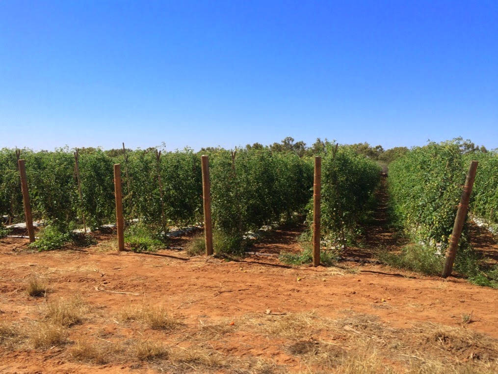
The Gascoyne River provides fresh water for irrigation and this area is a vital food production area.  Many fruits and vegetables are grown here and it was great to be able to buy plenty of fresh produce at the local growers market and farm doors.  Although the river is not flowing at this time of year, fresh water is never far from the surface as clay pans trap the water which can be pumped to the gardens.


There are plenty of tourist attractions in Carnarvon.  The indigenous cultural centre was well worth a visit.  The AV displays were excellent and we heard several stories from local aboriginal men and women.


The NASA space program and moon shots relied on the communications satellite dish at Carnarvon.  It's now been decommissioned and a group of volunteers runs the Carnarvon Space and Technology Museum.  Unfortunately it was closed during our visit.  The museum is being upgraded and Stage 2 was due to be opened by the Australian astronaut Andy Thomas a few days after our departure.


The Mile Long Jetty can be accessed either by walking or a ride on the Coffee pot Train.  A small charge helps to fund the upkeep of the train and jetty.  The harbours are home to the local fishing fleet.


We took a day trip north to Quobba Station - Where the Desert Meets the Ocean.  On our way we stopped off at The Blowholes where water flows into sea caves and is forced 20 metres into the air.


This is King Wave country and people have been washed from the cliffs and drowned.  The rugged, rocky coastline explains why there is a lighthouse nearby.


Further north we stopped at the Cairn which marks the sinking off the WA coast of HMAS Sydney by the German ship Kormoran on 19 November 1941.  There were no survivors from the Sydney and the circumstances of the battle and subsequent sinking remain controversial.  On our way back to Carnarvon we passed the pink salt lakes.  The pink colour is caused by bacteria which only live in salt water.  We've seen this effect before on our travels around the Yorke Peninsula in South Australia.  Dampier Salt harvest salt here.


While we were in Carnarvon, Cherryl was able to make contact with some west coast cousins she had never met.  It's great to catch up with new branches of the family tree.


Thursday, 11 September 2014

Where have we been in 2014

We've travelled a long way since we left Canberra at the end of January.

We travelled north through New South Wales and into Queensland.  After having some work done on the caravan on the Sunshine Coast, we headed inland across central Queensland before making our way back to the coast in the Cairns/Townsville area.


Back inland we progressed along the Savannah Way.  Once into the Northern Territory we made our way to Darwin after spending some time in the Kakadu National Park.  From Darwin we made our way further west through the Kimberley to the west coast.  We've followed the coastline and now we're at Carnarvon, almost as far west as we can go on the Australian mainland.

Excluding side trips, we've towed the caravan 13,400kms so far this year and we've still got a fair way to go before we finish our circumnavigation of the Australian mainland.

Wednesday, 10 September 2014

North West Cape

Two days of southwards travel from Karratha, we turned right and make our way north to Exmouth, near the northern tip of the North West Cape peninsula.  We were disappointed that we couldn't camp in the Cape Range National Park.  The campsites were all full at 10.30am, so we booked into the Exmouth Cape Holiday Park for 2 nights.

In the afternoon we set out to explore the area.  Our first stop is the Vlamingh Head Lighthouse.  The lighthouse was built after the cattle ship SS Mildura foundered on the rocks.  No human lives were lost but many cattle drowned as they tried to swim for the nearby shore.  The wreck can be clearly seen from the beach.


Near the lighthouse is an old radar tower surrounded by World War II sandbags.  On our way to the lighthouse we passed the ultra low frequency radio transmitters at the Harold E Holt Naval Communications Centre.  The many tall towers look like they could be communicating with another universe.

We drove back through the town and headed south towards the Charles Knife Gorge.  The road took us along the ridgeline with several places to pull over to admire the view and take some photos.  The scenery was spectacular and we looked out over the land where North West Cape oil was first discovered in the 1950s.


The next day we load up a picnic lunch and venture into the Cape Range National Park.  After checking out some of the campgrounds, we're not so disappointed that we aren't camping here.  (Today the campsites were filled before 9.30am!)  The campgrounds are pretty spartan and are cramped.  There are quite a few campgrounds, but they don't have space for many campers.  The main activity is snorkelling on the Ningaloo Reef which is a World Heritage Site.  The rocks at one of the beaches we stopped at were embedded with many fossilised shells.


The waters offshore are home to whales, manta rays, dugongs and whale sharks.  The reef has a huge diversity of corals and fish.  Snorkelling gear can be hired at the visitor centre.  Unfortunately we haven't come equipped for swimming so we have to be content with the static exhibits and video at the visitor centre.  The radio tower near the entrance has an osprey nest on its tip.


We didn't see any picnic tables (or even any shade) on our drive south along the coastline and after travelling about 35kms, we turned around after morning tea at Mandu-Mandu Gorge and a stop at Bloodwood Creek.


Just outside the park we stopped at the Jurabi Turtle Centre, an interpretative centre on a turtle nesting beach.  We had lunch under the shade sails.


We're starting to see some wildflowers and we've seen plenty of Sturt's Desert Peas and native hibiscus along the way.