Saturday, 30 August 2014

Zebra Rock Mine on the Banks of Lake Argyle

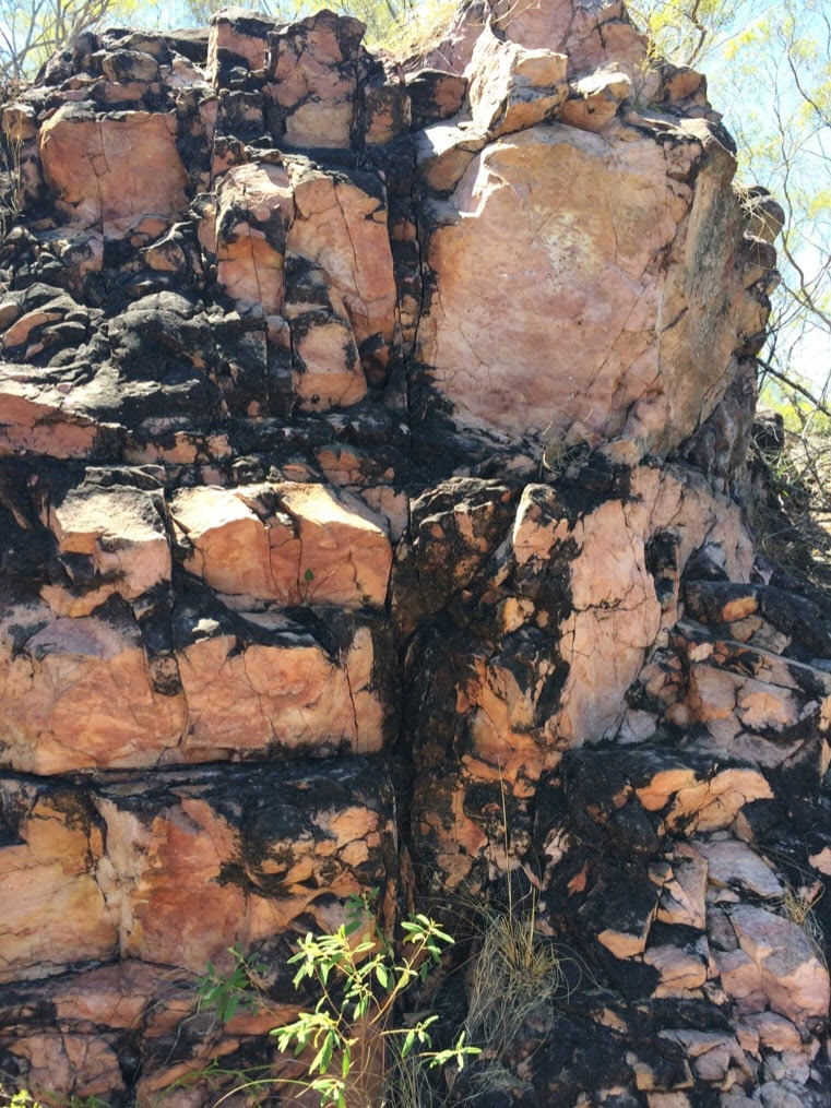
Just inside the Northern Territory, close to the Western Australian border is the Zebra Rock Mine, Gallery and Campground.  This is the only place on earth that the unique zebra rock can be found.  The patterned bands in the rock are formed under intense heat and pressure, the red/brown is iron.  Geologists are still debating how the rock is formed with its bands of amazing patterns between layers of sedimentary rock.  The gallery has many examples showing the patterns and we found a few pieces while we were fossicking around the campground.


On our first night we signed up for the sunset cruise on Lake Argyle.  More about the lake later.  This time we're looking for wildlife and scenery.


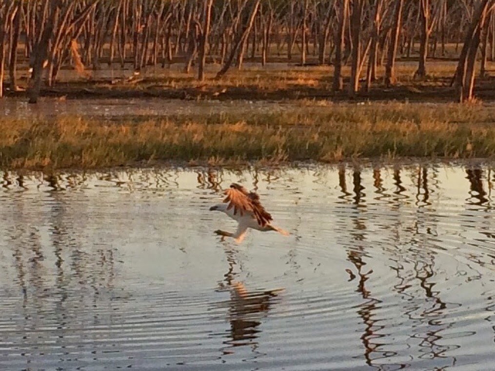
As we cruised around the eastern side of the lake we saw plenty of waterbirds and several freshwater crocodiles.  Cherryl did some fishing when we stopped for drinks and nibbles and managed to catch a silver cobbler (a type of catfish).  This osprey co-operated with our camera so we could get a photo of it fishing.


Back on the boat and the sun was starting to go down.  Only one word can describe the scenery at sunset - MAGNIFICENT!!!  We took plenty of photos and it's been hard to select the ones for this blog.


Back at the campground we tucked into fresh fish and chips which we'd ordered before we went on the cruise.


The next day we decided to venture into Western Australia to visit Lake Argyle from the western side.  The lake was formed by the damming of the Ord River, and it's huge.  The dam wall was opened in 1972 by the Prime Minister, William McMahon.  At that time the dam wall was 68m high and 355m long and the lake held 5.8million megalitres of water.    At that time it was the largest reservoir in Australia and it  opened up 76,000 hectares of land for irrigated agriculture.  The spillway was raised 6m in 1996 which almost doubled the lake's capacity.


The western side of the lake is very different to the eastern side with many cliffs and rocky hills.


We spent 3 nights at Zebra Rock and had a great time.  The fish and chips were great and Ruth's scones are to die for (we managed to have fresh cooked scones with jam and cream for morning tea each day).

Friday, 29 August 2014

West Towards the Kimberley

After a week in the Darwin area it's time for us to pack up and head south.  We've decided to spend the night camping at Edith Falls in the Nitmiluk National Park near Katherine.  We visited the falls when we were at Katherine a couple of weeks ago.  This time we have time to go for a swim in the plunge pool.  The next morning we turn right and head west towards Western Australia.


We camped overnight at Sullivans Creek in the Judburra/Gregory National Park and the next morning drove through the beautiful scenery around Victoria River.


Further down the Victoria Highway we drove through Timber Creek where we stopped off to visit Gregory's Tree.  This magnificent boab tree marks the site where the explorer Augustus Gregory camped on 2nd July 1856.  The area also has significant cultural significance to the local indigenous people.  Just east of Timber Creek is a memorial to the Durack family who were pioneer pastoralists through the area.  They are immortalised in the Australian Classics "Kings in Grass Castles" and "Sons in the Saddle" written by Mary Durack.

Tuesday, 19 August 2014

Same. Same - but Different; The Lost Cities of Litchfield

Having visited the Lost Cities of the Limmen National Park, we were keen to see the Lost Cities of the Lithchfield National Park.  As the post's title suggests; Same, Same - but Different!

We drove 11km off the main Litchfield Park Road along a well maintained 4WD road to see this attraction.  As we came towards the geological features, the sandstone pillars really did look like building ruins.  The placement of the rocks looked like there were rectangular windows in the rocks.


Further on at the end of the track we had our picnic lunch before setting off on the short walk around the rock formations.


The pillars here are mostly dark grey/black from an algae which forms on the outside of the porous rocks.  As with all sandstone, the rocks here are like a giant sponge which soaks up water in the wet season, releasing it during the dry season.

Then it was back along the 4WD track to Litchfield Park Road so we could continue exploring the park.


Litchfield National Park

One thing we can say about the Northern Territory - they do their National Parks very well.  Today we'll be spending the day in the Litchfield National Park.  One benefit of staying here at Berry Springs is that it's pretty central.  We can experience the delights of our natural environment with the Litchfield National Park only about 40kms away - if we go "the back way".  The road is good with only two 10km stretches of good quality unsealed road with the rest of Cox Peninsula Road and Litchfield Park Road sealed.  We packed up our morning tea and picnic lunch and headed for the bush about 9am.  As per the other days here, the weather is clear with bright blue skies and an expected maximum temperature of 32C (the nights are a bit chilly though at 10C.

About 45 minutes later we enter Litchfield National Park and stop off at the information board.  There are information boards at all of the main vantage points.  Estuarine (salty) crocodiles inhabit the waters here in the wet season and the swimming spots are closed in the dry season until all salties have been relocated.  Safe swimming places are well marked.


About 20km into the park we arrive at Wangi Falls.  This is a popular safe swimming and walking spot.  There are plenty of people swimming in the plunge pool.  We have our morning tea and decided to do one of the walks.  We walked past the falls lookout and up to the treetop lookout.  Robert decided to continue walking the loop walk while Cherryl returned via the path.


Back in the car our next stop is Tolmer Falls.  Another walk along a path past some pink sandstone rock to the lookout where we could see Tolmer Falls on one side and the picturesque valley on the other side of the path.  A few kms further down Litchfield Park Road we turned off to the
 Lost Cities.  I'll do a separate post on this.


Back from lunch at the Lost Cities our next stop is Buley Rockholes.  Another popular swimming place.  The round "holes" in the riverbed are caused by rocks caught in the depressions and acting like a scourer as the current forces them to spin around in the holes during the wet season.


Near the rock holes is Florence Falls.  This area is very popular and many people arrive in the morning and stay all day.  We stopped at the lookout because we didn't fancy walking up 172 steps in the afternoon heat after a visit to the plunge pool.


Our last stop before leaving the park was the Magnetic Termite Mounds.  We have seen these in a number of places, these are probably the largest ones we've seen.  The mounds are thin and flat and are in a north/south alignment.  It's nothing to do with them being magnetic, it's all about temperature control.  The north/south alignment keeps the interior of the mound at the correct temperature.  These mounds look like headstones in a graveyard.  not all termite mounds are "magnetic", some are just BIG - these are about 5-6m high.


After our stop at the termite mounds we left the national park and drove to the nearby town of Batchelor where we stopped for an ice-cream before making our way back to our caravan.