 We left Esperance and travelled north for about 200km to Norseman, on the Eyre Highway which links Perth on the West Coast to Port Augusta at the top of South Australia's Spencer Gulf. Our first night was spent free camping at Ten Mile Rocks, about 100km east of Norseman on the edge of the Dundas Nature Reserve near the Fraser Range.


The next morning we stopped off at the Balladonia Roadhouse, about 100km on, for coffee. What a surprise this little gem turned out to be. In July 1979 the US space station "Skylab" crashed to earth near here. The little museum has quite a lot of information about Skylab and there are several large pieces of Skylab on display, together with plenty of newspaper cuttings. One interesting item is a copy of the council infringement notice NASA received for "littering".

Balladonia was a stop over point for the Red-X trials in the 1950s and there's a display dedicated to them too.

The road between Balladonia and Caiguna is the longest straight stretch of road in Australia - 146.6km (90 miles). There's a golf course along the Nullarbor with named holes at most of the towns. The hole at Caiguna is called "90 Mile Straight". Many travellers play the course and there's an annual competition with the winners' shield displayed at the Caiguna Roadhouse. Just past Caiguna we moved into the Central West Time Zone, 45 minutes ahead of Perth.

Further eastwards we booked into the caravan park at Cocklebiddy. Much of the Nullarbor is limestone and this area is littered with caves. In our caving days we would have loved to spend some time underground exploring the Nullarbor Caves. Cocklebiddy really is remote and like many stops along our way it has camping and motel accommodation.


 We farewelled WA and said "hello again" to SA as we crossed the border into South Australia, adjusted our clocks to Central Summer Time ( +1h45m) and entered the Nullarbor National Park. We drove onto the "Treeless Plain" which is well named. In WA we were surprised to see so many trees along the way. Once we hit SA there was not a tree to be seen for several hundred kms.


We had a brief stop at the Nullarbor Roadhouse to stretch our legs. The old telephone exchange is a reminder of times gone by.


 The highway followed the coastline and we stopped off at several lookouts to admire the amazing coast of the Great Australian Bight. The cliffs are a sheer drop of 90m into the sea.

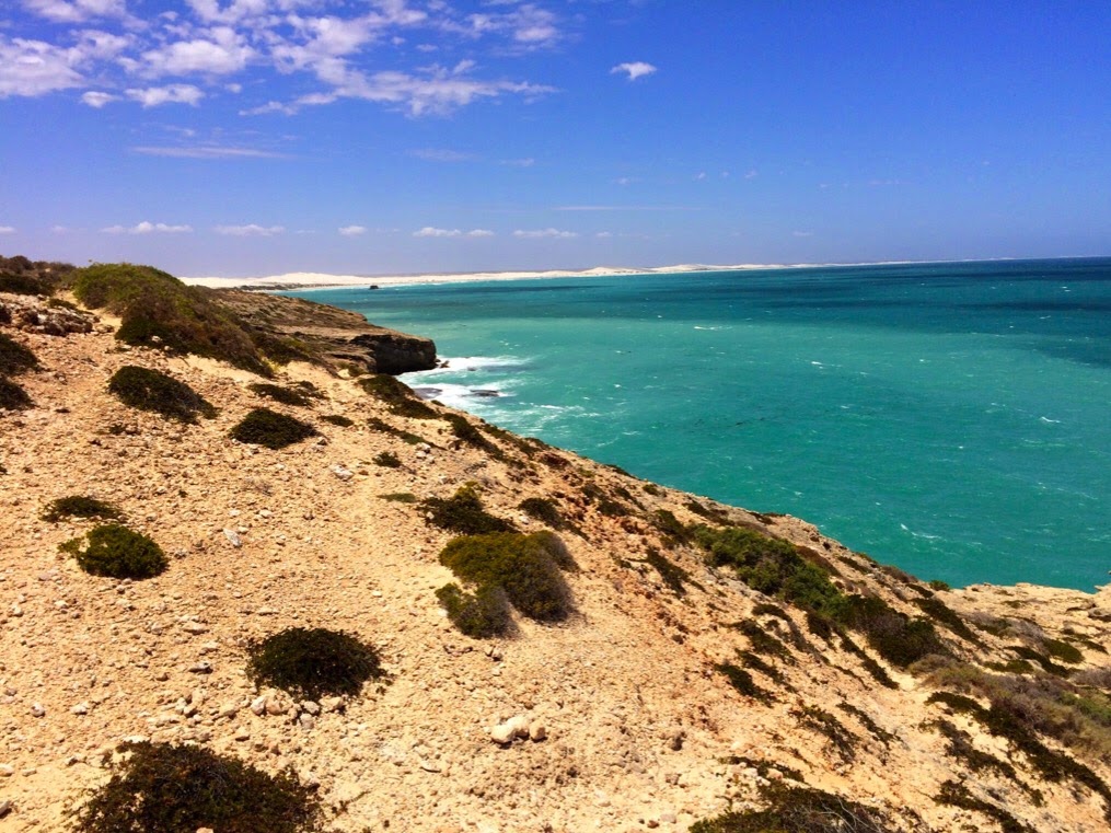 We decided to camp at the Head of the Bight and drove to the Visitors Centre 11 kms south of the highway. This is definitely a "must see". There are excellent walks from the Visitor Centre to see the Bunda Cliffs to the west and white sandhills to the east - a real contrast. From April to October each year this is a popular whale watching area with up to 170 whales in the bay at the same time.


Our trip across the Nullarbor ended as we drove into Ceduna after passing through the SA fruit and vegetable quarantine inspection point. This also marked our completion of "The Long Lap" around Australia because we visited Ceduna in November 2013.
No comments:
Post a Comment